|
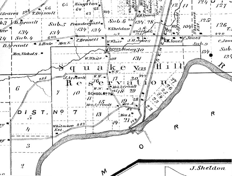
Although the Senecas had sold the land nearly a half century earlier, the boundaries of Squawkie Hill were included on a map of the Town of Leicester found in the 1872 Atlas of Livingston County. A portion of the map is found below. Some modern landmarks may help to locate a portion of the Reservation. In the lower left you will see the "Whitmore Est." which was near the western boundary of the Reservation. That dwelling stood just to the north east of the modern Dam Restaurant and overlook. When you travel from the Restaurant to the Mt. Morris entrance, you are passing through the main part of Squawkie Hill! Long after the reservation was sold, the home of "Buffalo Tom" Jemison, grandson of Mary Jemison. His log cabin appears on the map just below the "r" in Reservation and above "165". At the time the map was made, the home belonged to "Mrs Ayrault". As always, we thank Ted Bartlett for sharing the historical information of Buffalo Tom's Cabin! For more information on Squawkie Hill see our Glimpse of Seneca Villages in Letchworth State Park. |