|
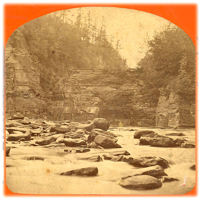
Stereoview
"286
Table Rock Lower Falls, from below"
"Western
New York Scenery."
George Washburn,
Castile, NY
1860s
The photographer
was probably set up on a large flat rock when he took this image
from the riverbed below the Lower Falls. In the center is the
north face of "Table Rock", to the left part of Sugar Loaf rock is visible. Between
them one can make out the "V" of the Flume.
Long ago this was the location of the last of the three main Portage
Falls,
with the Genesee River tumbling over the edge of Table Rock to
form a waterfall comparable to the Upper Falls in height. Eventually
the river found a weakness in the bedrock and dug the channel
along the east side of the gorge, leaving Table Rock high and
dry. See a enlarged image below. Click here to see another view Table Rock,
including the Lower Falls area during the Flood of 1972. Also see Hall's Sketch of the Lower Falls.

The
stereoview is from the Clark Rice Collection, Perry Public Library,
70 N Main Street, Perry NY 14530. We thank Peggy Parker at the
Library for allowing us to use the image. We also thank Betty
Rice for her constant support and assistance.
|
