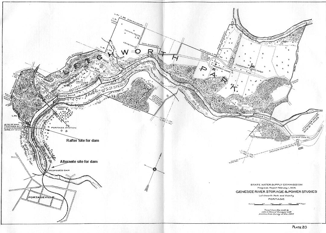
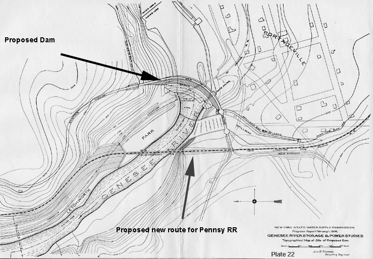
From the 1896 to 1911 the Glen Iris Estate was faced with a plan to create a dam to the south at Portageville. Below are maps from the project report. For more information on this project, see our Glimpse entitled Glen Iris Threatened and Portageville Dam Drawings.
Inages below from Genesee River Storage & Power Studies,
State Water Supply Commission, 1908. The first image uses a map
done by J. Minard in 1906 to show the location of the proposed
dam sites in the Portageville area. The second map provides
a detailed look at the dam location south of the Portage Bridge.

