|
|
|
|
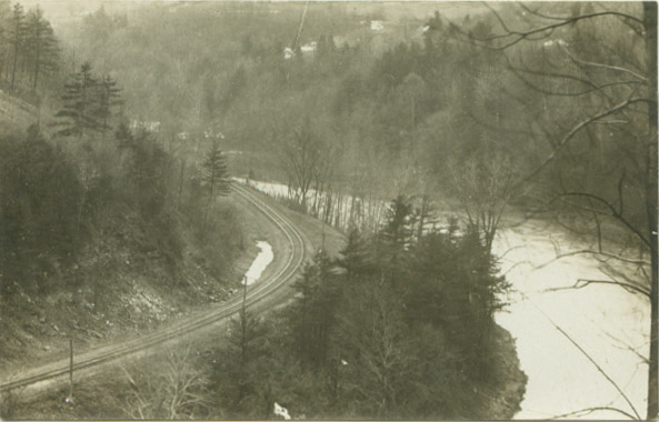
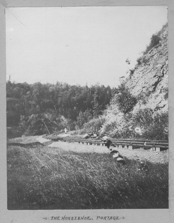
South of the Erie Railroad Bridge, the Pennsy passed through what was known in Canal days as the "Rock Cut", then around 'Horseshoe Bend" to arrive at the railroad bridge across the Genesee at Portageville. |
| This undated real photo postcard was taken from the west bank of the gorge toward Portageville. The "Rock Cut" would be to the left of the picture, with part of Portageville visible on the far bank. The Pennsy bridge across the Genesee is just beyond the bend. |
 |
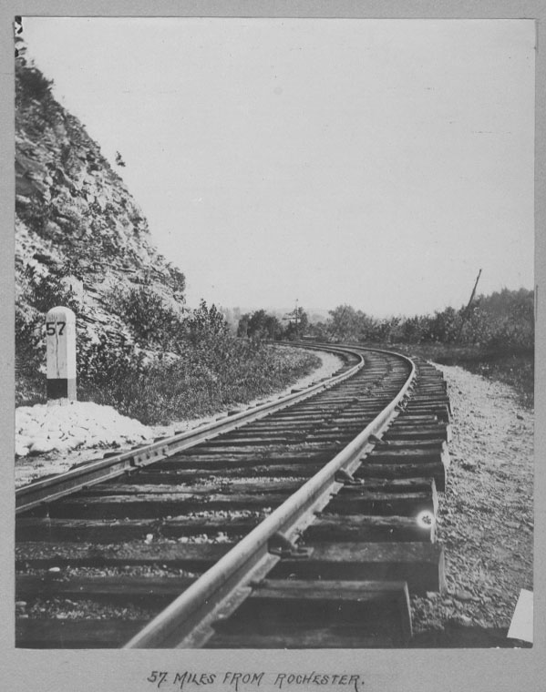
| This photograph was from the same album as the image from Part II with the two men along the tracks. The photographer was standing in the rock cut near mile post 57 looking south toward the horseshoe curve and Portageville. The Genesee River would be to the right. |
 |
| Another from the same album, a little closer to Portageville, but looking northwest. The trestle across the Genesee would have been visible, but unfortunately, the photographer didn't include it in his album. |
 |
|
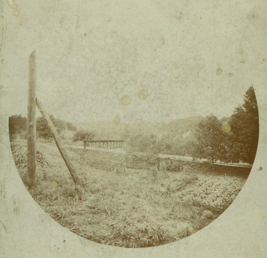
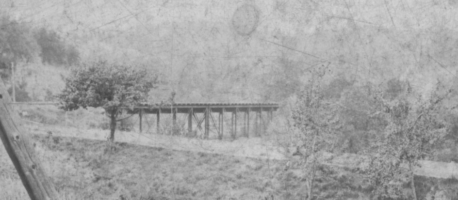
When we originally created this page, we asked if anyone had an image of the Pennsy railroad bridge at Portageville. Looking through some early Kodak photographs from the 1880s or 90s in my collection, I came across this one labeled. "View from Portage Village Looking down the river, W.N.Y. & Penn. R.R. Bridge"! Not the best image, but the best we have so far!. The image was taken from Portageville (the person writing the label was mistaken) looking northwest across the main street toward the river and the present day Park. Note the garden in the foreground. An enlargement of the bridge is found below along with a map showing the bridge and tracks in and near Portageville. |
|
|
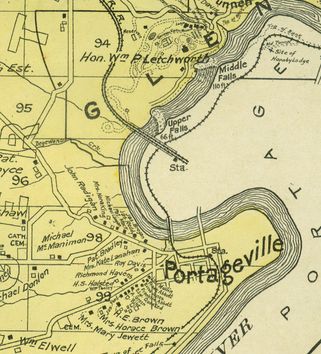
The map of the Town of Genesee Falls from the 1902 Century Atlas of route of the Pennsylvania RR as it passed under the Erie Bridge , through the Rock Cut, around the Horseshoe Bend, and across the bridge at Portageville. If you click on the map you go to a detailed map of Portageville from the same atlas. |
 |