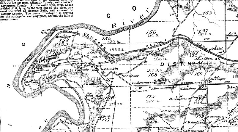
The image below was taken from the Town of Portage Map found in the 1872 Livingston County Atlas. It shows the area to the east of the original Glen Iris Estate, and marks the location of the Upper, Middle and Lower Falls. Also shown is the route of the Genesee Valley Canal. Click here to see more of the Portage area.