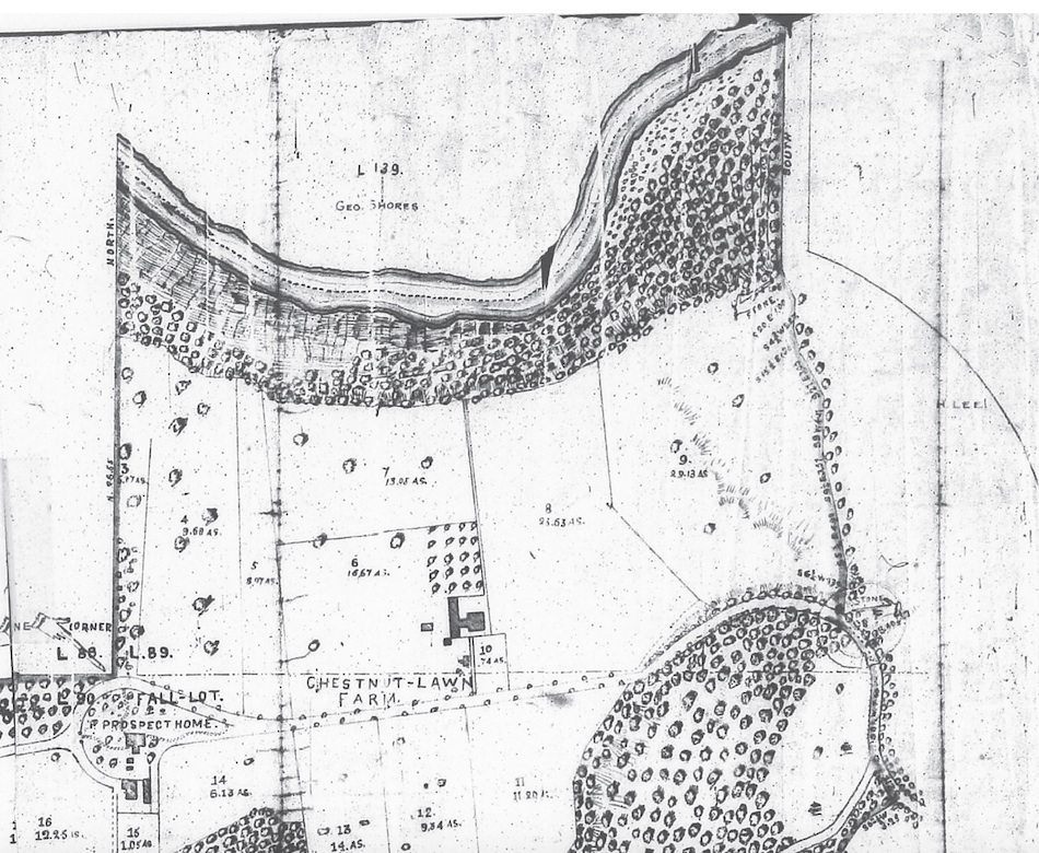
Glen Iris Estate Map by John Minard
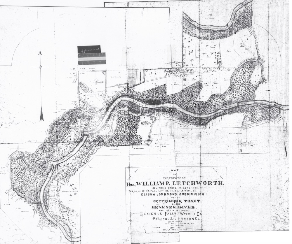
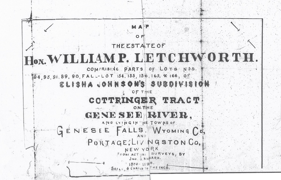
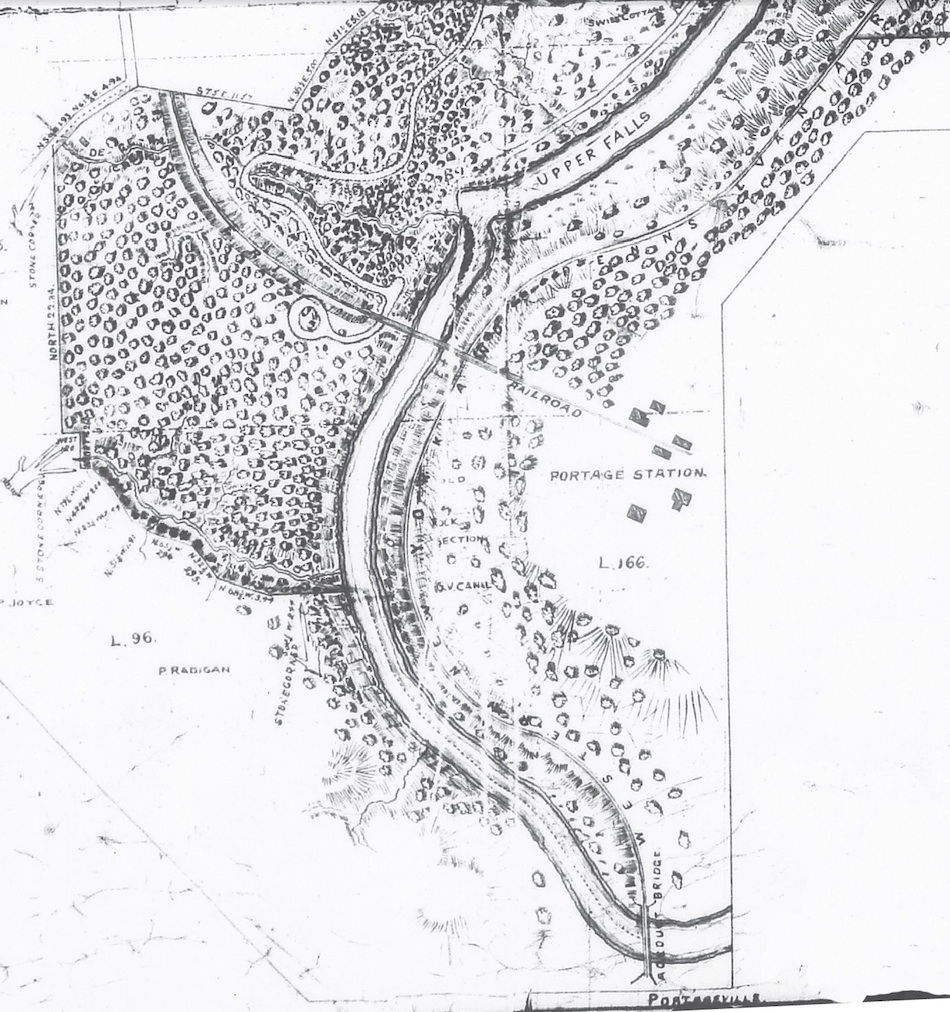
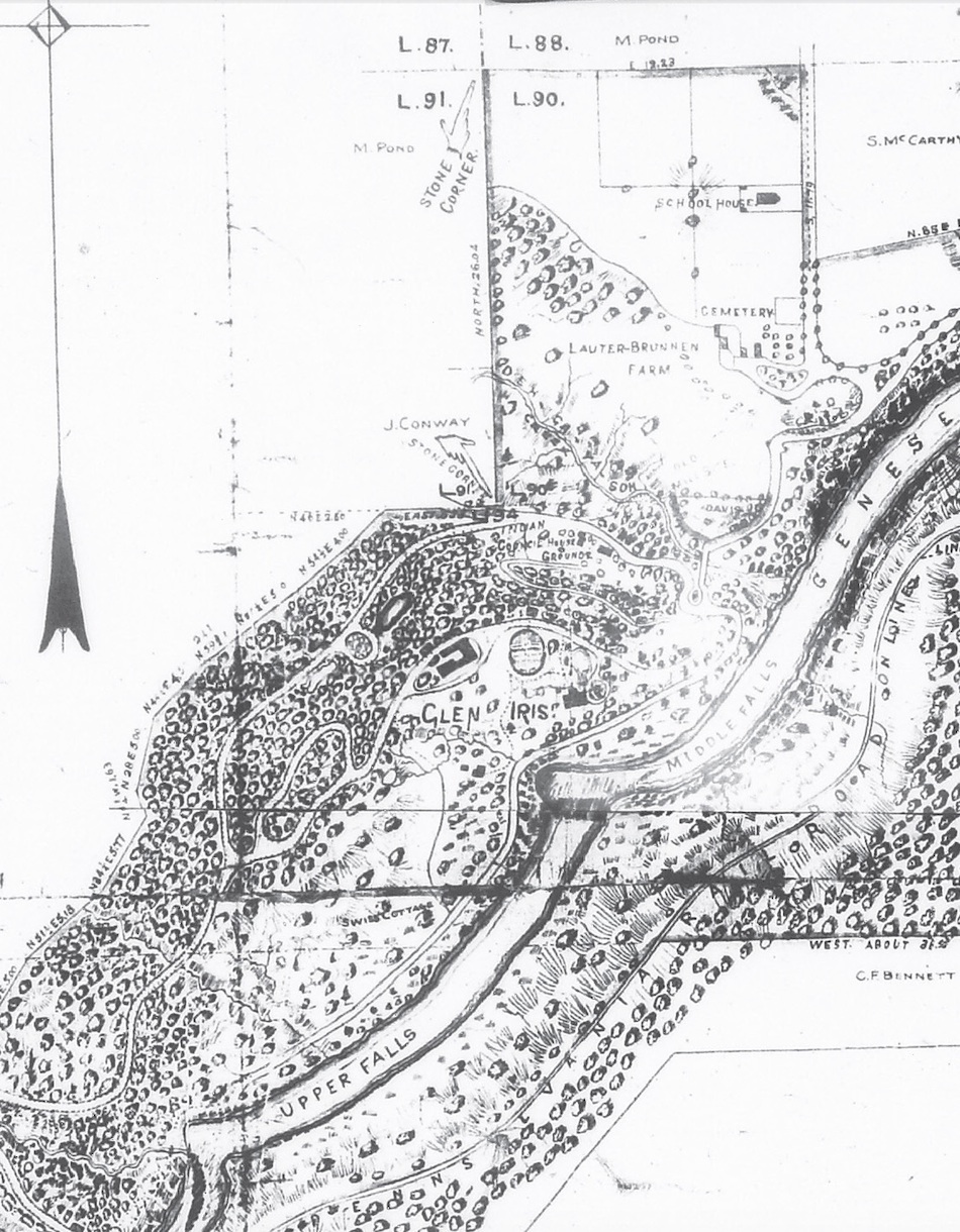
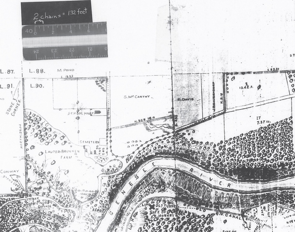
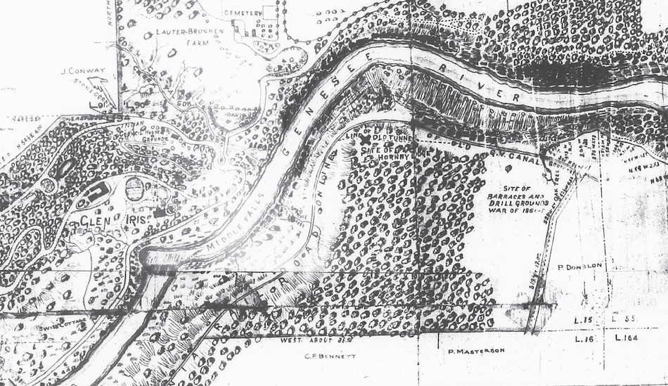
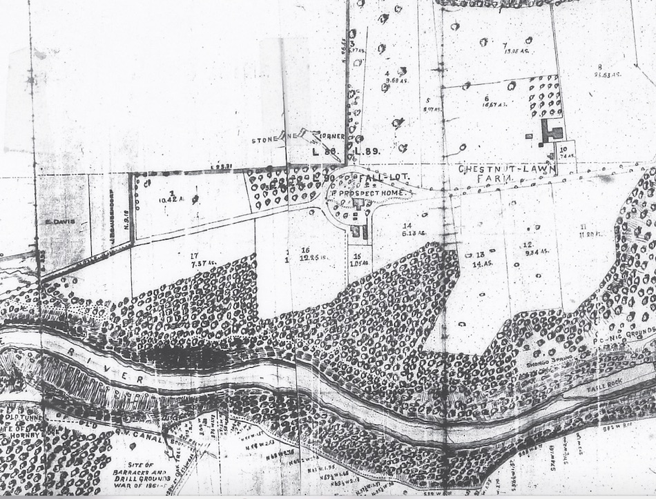
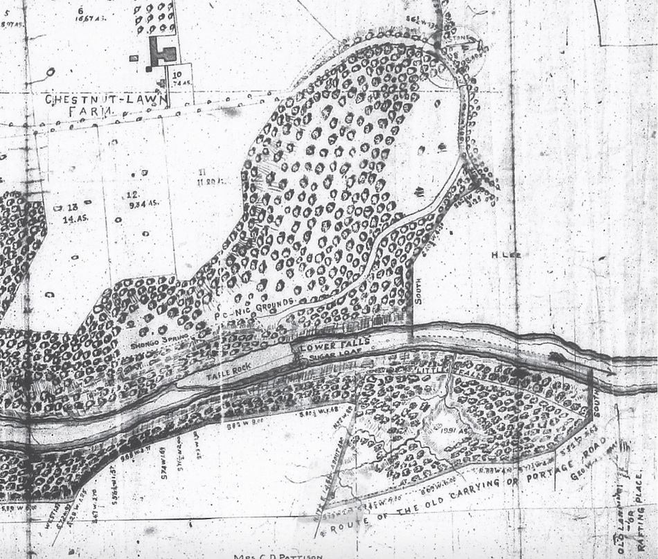
The map below was found in the Wyoming County Clerk's office by Tom Breslin in the summer of 2015. It was done by John Minard of Allegany County for Mr. Letchworth around 1890 and shows in detail the lands that Mr. Letchworth had acquired which made up his Glen Iris Estate. To see a tabulation and listing of the various purchases, click here. We have also used this map as a base map in our chronological description of the development of the Glen Iris Estate, as found here. You will find enlarged portions of the map as you scroll down. A copy of this map can also be found on display in the William Pryor Letchworth Museum at the Park.
|
 |
 |
 |
 |
 |
 |
 |
 |
 |